mkml (make kml and kmz) 5.2 is a batch server software (windows, linux, hpux, solaris, aix, … and every OS supported by perl) to make kml (kmz, compressed kml, on windows). Starting from files (or standard input) with inside a list of points can make a map with lines and/or points.
- INPUT FILE format
- Configuration file
- Registration
- Examples
- Download
- History
- How can I view kml files?
- How can I embed kml?
INPUT FILE format
The format of the input file has to be a sequence of points (placemarkers and/or lines) like (you can use also comments, line that start with hash symbol, or blank lines)
latitute;longitude;(altitude optional);(title optional);(body optional, you can write html code)
A line that start with # is a comment.
A line that start with #! is a special comment that can be a command:
#!new=line color;point color;folder name;line name;noline#
to set the line color and the line name, the points color, the folder name, the line name and if you want with the point to make a line or not.
This is a valid line
11.733613014221191;44.957479650570484;0.0;End;<b>End Point</b>
will add over the point 11.733613014221191;44.957479650570484;0.0 of the line a balloon with the title End and inside the html code <b>End Point</b>
RUN mkml
mkml *.txt will convert all the .txt files into .kml files
On unix cat your_filename | mkml – will print into standard output the kml file
On windows (dos) more your_filename | mkml –
Configuration file
The configuration file is mkml.cfg in the same directory where you run mkml
These are the fields you can set editing it:
documentname the kml name of Document and name and description of the line
foldername the first foldername (if you don’t want to use #!new=line color;point color;folder name;line name;noline# for the first set of points)
linename the first linename (if you don’t want to use #!new=line color;point color;folder name;line name;noline# for the first set of points)
width the width of the line (default is 4)
pointcolor the color of the first group balloons (default is ffffffff – white)
linecolor the color of the first line (default is ffffffff – white)
noline if set 1 you can see only the points with description (default is 0 – design the line)
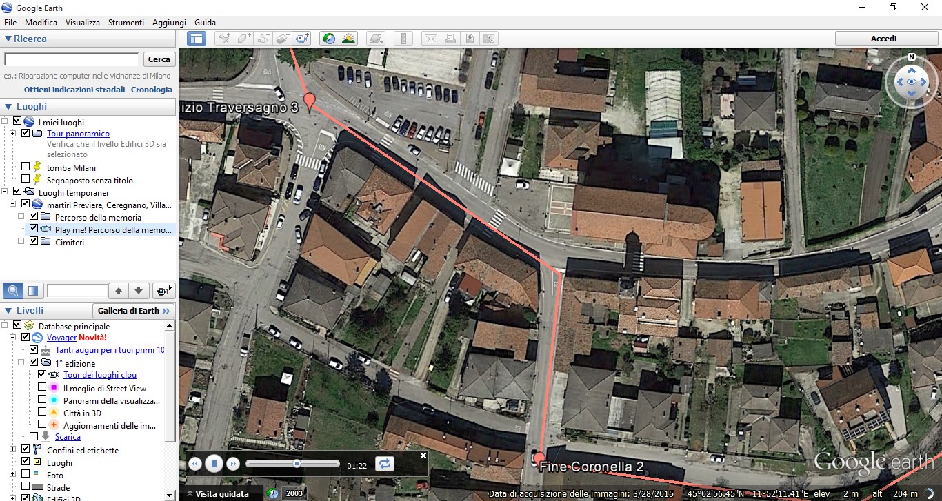
tour to add a tour (an animation that start from the first point of the line to the last: the play me feature). With tour: 1 the animation will be for every point, with tour: 2 the animation will be only for pin points, with tour: 3 the animation will be only for pin points and every pin point is opened. Default is 0, no tour.
altitudetour the altitude of the tour
duration the time the tour has to stop in every point. Default is 1.0
On windows
compress default is 1 to create kmz (kml compressed). It’s possible to set to 0 to don’t create compressed kml
CompressionLevel from 0 to 9, default 6
Registration
mkml is free only for personal use, for commercial (business) use the fee for every license is euro 50 + 5 euro for every physical core (for virtual servers euro 80 + 10 euro for every virtual core).
Write us to register your license info (@) pivari . com
If you can send us examples of your final kmls or description of your use of our software we will make you a special fee.
Examples
input file for special cycle path
output kmz file for special cycle path. This example use new 5.x mkmkl feature tour.
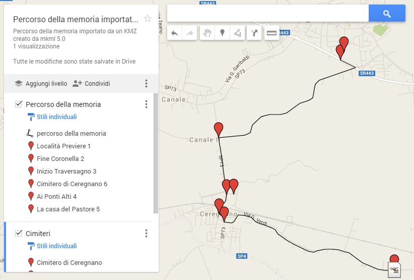
input file for monuments of Virgilio Milani at Rovigo, Italy
output kmz file for monuments of Virgilio Milani at Rovigo, Italy
input file for Piste Ciclabili (cycle paths) Rovigo, Italy
output kmz file Piste Ciclabili (cycle paths) Rovigo, Italy
Downlooad
Here you can download the software:
If you want to test the software in stranger OS like openvms, Z series, AS/400, SCO, … using perl, ask us the perl mkml code.
- 01/10/2016 5.2: added tour: 3 that allows like tour: 2 to make a tour only for pin points and open every pin
- 11/14/2015 5.1: added tour: 2 to make a tour only for pin points
- 09/18/2015 5.0: added tour (play me), altitudetour, duration to create an animation from the first point to the last https://youtu.be/s0Odk5BwSQg
- 06/19/2015 4.2: added noline in #!new=line color;point color;folder name;line name;noline#
- 01/25/2015 4.1: you can set in mkml.cfg compression and CompressionLevel
- 11/08/2014 version 4.0: new name, windows executable can make kmz (compressed kml) on windows, substitute the generic color with pointcolor and linecolor
- 05/14/2014 version 3.0: in the input data (or data file) is possibile to use
#!new=line color;point color;folder name;line name#
e.g. #!new=ffA95B3F;ffA95B3F;Le opere nel cimitero di Rovigo;# - 04/25/2014 version 2.0: With noline : 1 you can see only points that have descriptions
In input file you can insert blank lines and/or comments (hash symbol followed by chars) after spaces - 01/25/2014 version 1.0: the first public release
Write us the features you need in the next releases. We will add them!
How can I view kml files?
Best kml viewer (client fow Win, Mac and Linux and recently Andoid and iOS) is Google Earth.
It’s possible to use web apps and apps for Android and iOS.
Importing kmz or kml with animation made by mkml into Google My Maps, you loose animation and colors 🙁
We will study better the compatibility in the next releases